Skip to Content
Scottish Pictures
Home
Maps
Views
Other Prints
Delivery
Contact
0
0
Scottish Pictures
Home
Maps
Views
Other Prints
Delivery
Contact
0
0
Home
Maps
Views
Other Prints
Delivery
Contact
Scottish County/Region Maps Knapdalia Provincia ……….
BZ4R5457.png Image 1 of
BZ4R5457.png
BZ4R5457.png

Knapdalia Provincia ……….

£225.00

Cartographer / Engraver: Timothy Pont

Medium / Size: Copperplate engraved map / c.425 x 535mm

Date: 1662

Add To Cart

Cartographer / Engraver: Timothy Pont

Medium / Size: Copperplate engraved map / c.425 x 535mm

Date: 1662

Cartographer / Engraver: Timothy Pont

Medium / Size: Copperplate engraved map / c.425 x 535mm

Date: 1662

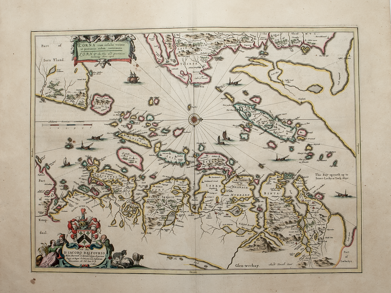
Brief Description: Loch Crinan in N.W. of map to Tarbert in S.W., Sound of Jura to West and Loch Fyne to East; original colour; Latin text verso; excellent condition 

You Might Also Like

BZ4R5436.png
Vistvs insvla vulgo Viist ………
£250.00
BZ4R5438.png
Mvla Insvla ……
£325.00
North & South Ross & Cramontry.png North & South Ross & Cramontry.png North & South Ross & Cramontry.png
Northern and Southern parts of Ross & Cromarty Shires – published by John Thomson in his Atlas of Scotland
£125.00
BZ4R5693.png
Southern part of the Western Isles – published by John Thomson in his Atlas of Scotland
£85.00
Argyllshire.png Argyllshire.png Argyllshire.png
Northern and Southern parts of Argyllshire – published by John Thomson in his Atlas of Scotland
£275.00
Email Us


Trading Terms & Customer Information


Scottish Pictures

Email: ian@scottishpictures.com


Privacy Policy