Skip to Content
Scottish Pictures
Home
Maps
Views
Other Prints
Delivery
Contact
0
0
Scottish Pictures
Home
Maps
Views
Other Prints
Delivery
Contact
0
0
Home
Maps
Views
Other Prints
Delivery
Contact
Scottish County/Region Maps Fifae Pars Orientalis
BZ4R5448.png Image 1 of
BZ4R5448.png
BZ4R5448.png

Fifae Pars Orientalis

£325.00

Cartographer / Engraver: probably Timothy Pont

Medium / Size: Copperplate engraved map / c.425 x 530mm

Date: 1654

Add To Cart

Cartographer / Engraver: probably Timothy Pont

Medium / Size: Copperplate engraved map / c.425 x 530mm

Date: 1654

Cartographer / Engraver: probably Timothy Pont

Medium / Size: Copperplate engraved map / c.425 x 530mm

Date: 1654

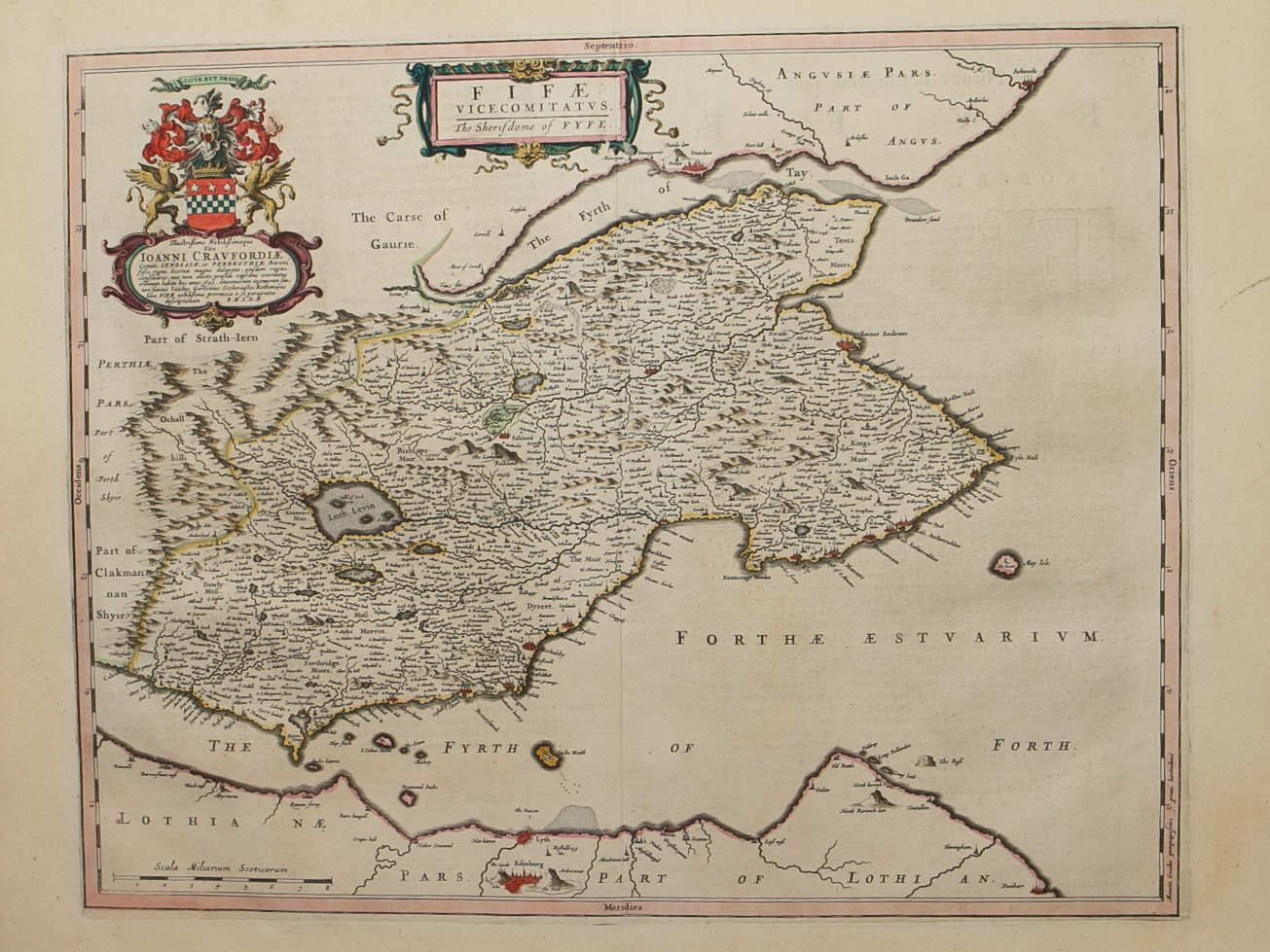
Brief Description: The Eastern part of Fife; notable towns shown include Burntisland, Kirkcaldy,  St. Monance,  Pittenweem, Anstruther, Crail & St Andrews; original colour, Dutch text verso  

You Might Also Like

Angusshire.png Angusshire.png Angusshire.png
Northern and Southern parts of Angus-shire – published by John Thomson in his Atlas of Scotland
£175.00
BZ4R5974.png
Perth
£65.00
sold out
BZ4R5840.png
Fifae Vicecomitatvs – The Sherifdome of Fyfe
£500.00
BZ4R5975.png
Fife and Kinross
£45.00
BZ4R5449.png
Fifae ParsOccidentalis – The West Part of Fife
£225.00
Email Us


Trading Terms & Customer Information


Scottish Pictures

Email: ian@scottishpictures.com


Privacy Policy