Skip to Content
Scottish Pictures
Home
Maps
Views
Other Prints
Delivery
Contact
0
0
Scottish Pictures
Home
Maps
Views
Other Prints
Delivery
Contact
0
0
Home
Maps
Views
Other Prints
Delivery
Contact
Scottish County/Region Maps Northern and Southern parts of Dumfries-shire – published by John Thomson in his Atlas of Scotland
Dumfrieshire.png Image 1 of 5
Dumfrieshire.png
BZ4R5636.png Image 2 of 5
BZ4R5636.png
BZ4R5639.png Image 3 of 5
BZ4R5639.png
BZ4R5638.png Image 4 of 5
BZ4R5638.png
BZ4R5637.png Image 5 of 5
BZ4R5637.png
Dumfrieshire.png
BZ4R5636.png
BZ4R5639.png
BZ4R5638.png
BZ4R5637.png

Northern and Southern parts of Dumfries-shire – published by John Thomson in his Atlas of Scotland

£185.00

Cartographer / Engraver: Crawford & Son / Sidney Hall

Medium / Size: 4 x copperplate engraved maps / 4 x c.515 x 640mm

Date: 1828

Add To Cart

Cartographer / Engraver: Crawford & Son / Sidney Hall

Medium / Size: 4 x copperplate engraved maps / 4 x c.515 x 640mm

Date: 1828

Cartographer / Engraver: Crawford & Son / Sidney Hall

Medium / Size: 4 x copperplate engraved maps / 4 x c.515 x 640mm

Date: 1828

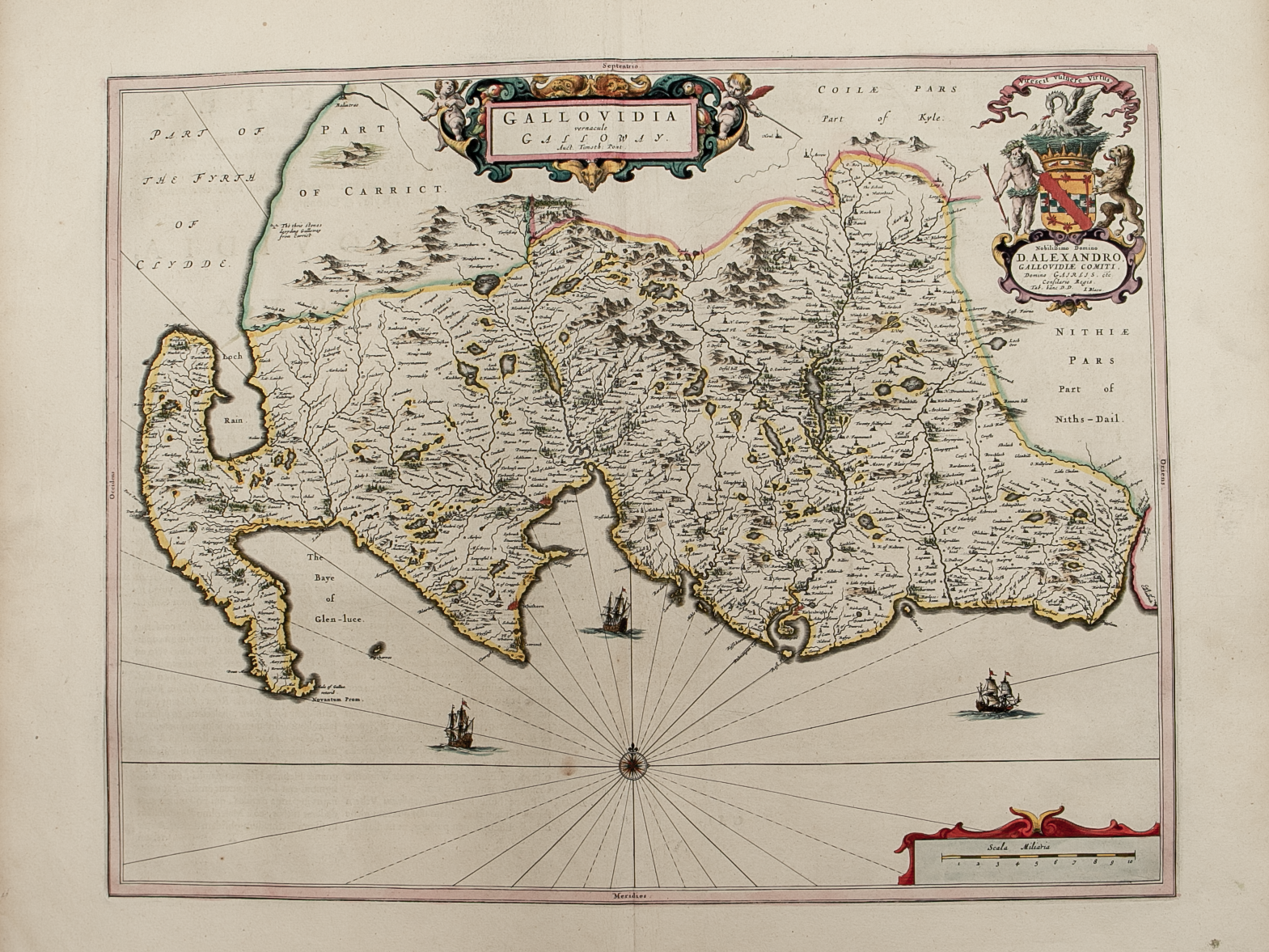
Brief Description: County engraved on 4 large sheets; original outline colour; very good condition

You Might Also Like

Roxburghshire.png Roxburghshire.png Roxburghshire.png
Northern and Southern parts of Roxburghshire – published by John Thomson in his Atlas of Scotland
£185.00
BZ4R5694.png
County of Wigton – published by John Thomson in his Atlas of Scotland
£125.00
BZ4R5467.png
Annandiae Prefectura, Vulgo The Stewartrie of Annandail
£225.00
BZ4R5465.png
Gallovidia vernacule Galloway
£250.00
BZ4R5657.png
Northern Part of Kirkcudbright-shire – published by John Thomson in his Atlas of Scotland
£50.00
Email Us


Trading Terms & Customer Information


Scottish Pictures

Email: ian@scottishpictures.com


Privacy Policy