Skip to Content
Scottish Pictures
Home
Maps
Views
Other Prints
Delivery
Contact
0
0
Scottish Pictures
Home
Maps
Views
Other Prints
Delivery
Contact
0
0
Home
Maps
Views
Other Prints
Delivery
Contact
Scottish County/Region Maps Kincardineshire – published by John Thomson in his Atlas of Scotland
BZ4R5655.png Image 1 of
BZ4R5655.png
BZ4R5655.png

Kincardineshire – published by John Thomson in his Atlas of Scotland

£95.00
sold out

Cartographer / Engraver: Wm. Johnston / Hewitt, London

Medium / Size: copperplate engraved map / c.540 x 695mm

Date: 1822

Add To Cart

Cartographer / Engraver: Wm. Johnston / Hewitt, London

Medium / Size: copperplate engraved map / c.540 x 695mm

Date: 1822

Cartographer / Engraver: Wm. Johnston / Hewitt, London

Medium / Size: copperplate engraved map / c.540 x 695mm

Date: 1822

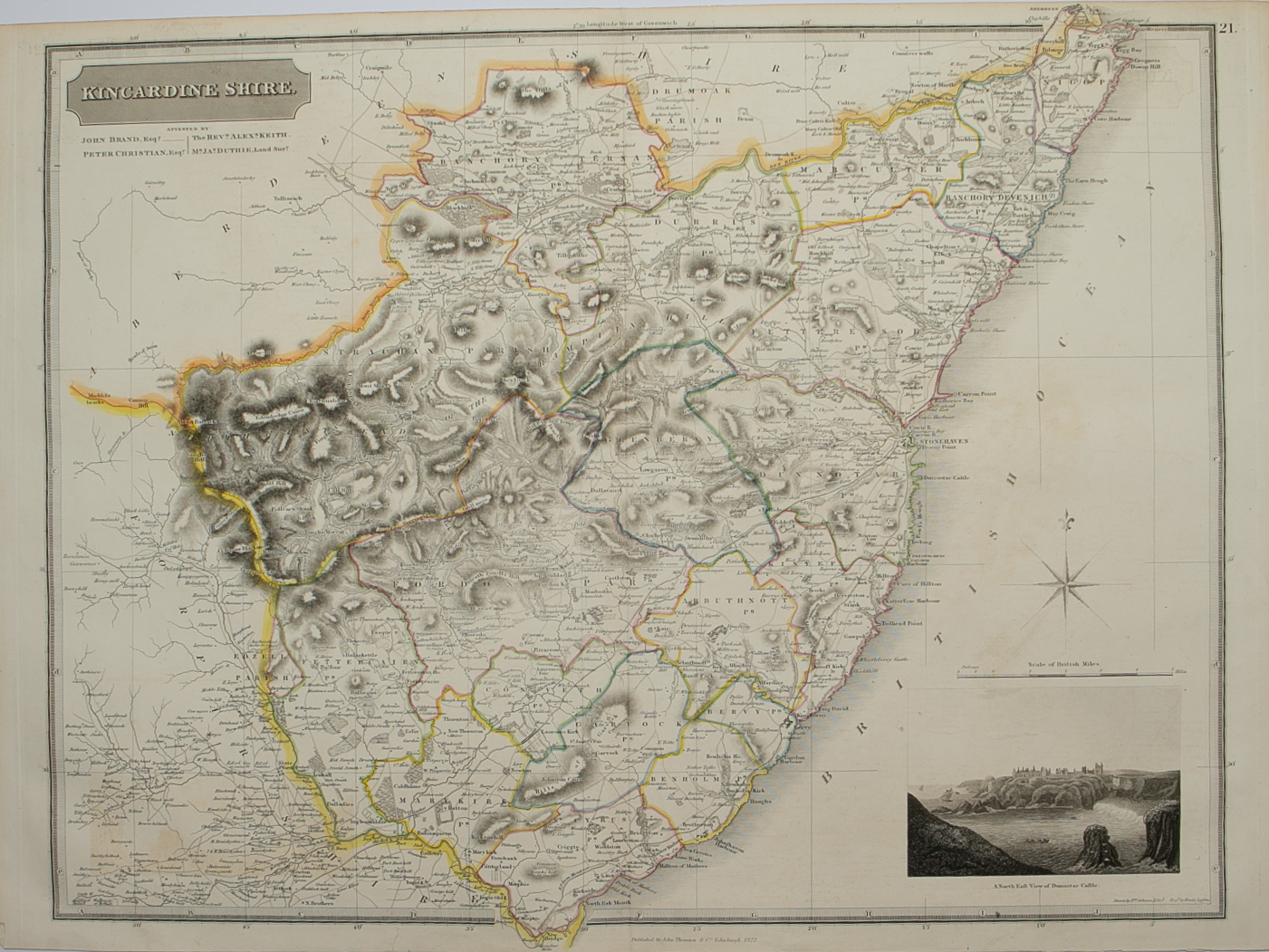
Brief Description: East coast county engraved on 1 sheet; original outline colour; inset engraved view of the north east view of Dunnotar Castle; very good condition 

You Might Also Like

Aberdeen & Banff.png Aberdeen & Banff.png Aberdeen & Banff.png Aberdeen & Banff.png Aberdeen & Banff.png
Aberdeen and Banff Shires – published by John Thomson in his Atlas of Scotland
£295.00
BZ4R5977.png
Moray & Nairn
£45.00
BZ4R5976.png
Aberdeen & Banff
£45.00
BZ4R5664.png
Nairn and Elgin – published by John Thomson in his Atlas of Scotland
£125.00
Email Us


Trading Terms & Customer Information


Scottish Pictures

Email: ian@scottishpictures.com


Privacy Policy