Skip to Content
Scottish Pictures
Home
Maps
Views
Other Prints
Delivery
Contact
0
0
Scottish Pictures
Home
Maps
Views
Other Prints
Delivery
Contact
0
0
Home
Maps
Views
Other Prints
Delivery
Contact
Scottish County/Region Maps County of Wigton – published by John Thomson in his Atlas of Scotland
BZ4R5694.png Image 1 of
BZ4R5694.png
BZ4R5694.png

County of Wigton – published by John Thomson in his Atlas of Scotland

£125.00

Cartographer / Engraver: Wm. Johnson / J. & G. Menzies

Medium / Size: copperplate engraved map / c.540 x 675mm

Date: 1826

Add To Cart

Cartographer / Engraver: Wm. Johnson / J. & G. Menzies

Medium / Size: copperplate engraved map / c.540 x 675mm

Date: 1826

Cartographer / Engraver: Wm. Johnson / J. & G. Menzies

Medium / Size: copperplate engraved map / c.540 x 675mm

Date: 1826

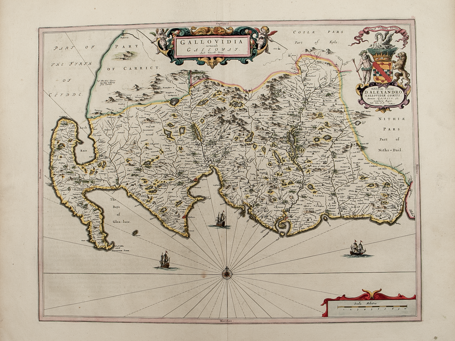
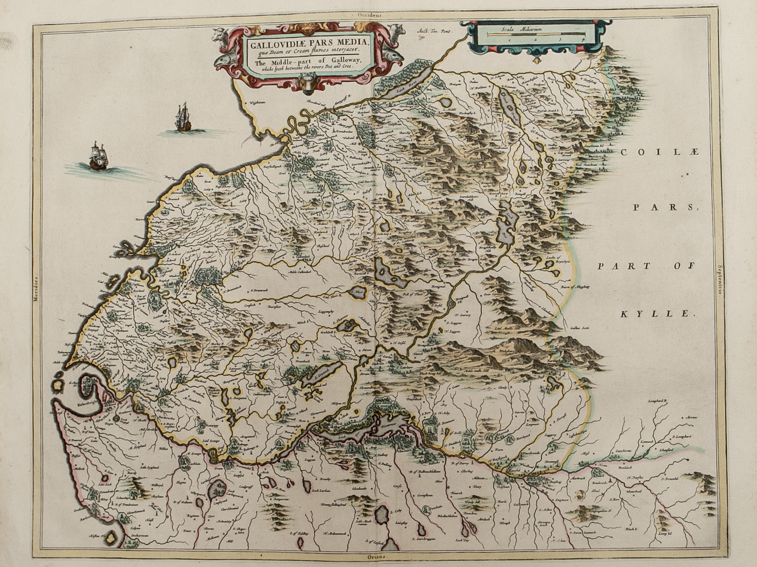
Brief Description: South west tip of Scotland; original outline colour; map trimmed to neat line at top of map with no loss of map printed area, otherwise good condition
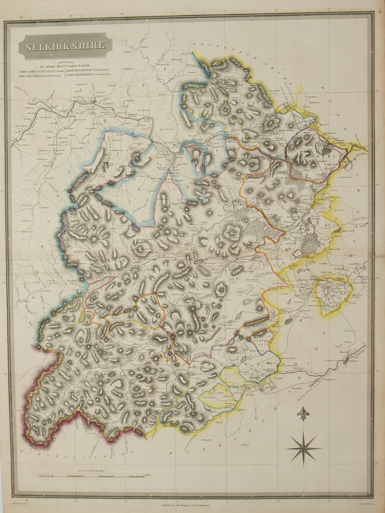
You Might Also Like

BZ4R5466.png
Nithia Vicecomitatvs – The Sherifdome of Njdjs-Dajl
£225.00
Roxburghshire.png Roxburghshire.png Roxburghshire.png
Northern and Southern parts of Roxburghshire – published by John Thomson in his Atlas of Scotland
£185.00
BZ4R5671.png
Peebles-shire – published by John Thomson in his Atlas of Scotland
£125.00
BZ4R5464.png
Gallovidiae Pars Occidentalior ……….
£250.00
BZ4R5462.png
Praefectvra Kircvbriensis …………
£225.00
Email Us


Trading Terms & Customer Information


Scottish Pictures

Email: ian@scottishpictures.com


Privacy Policy