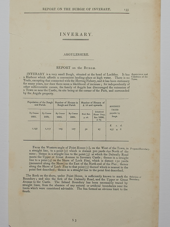
Skip to Content
Scottish Pictures
Home
Maps
Views
Other Prints
Delivery
Contact
0
0
Scottish Pictures
Home
Maps
Views
Other Prints
Delivery
Contact
0
0
Home
Maps
Views
Other Prints
Delivery
Contact
Town Plans Plan of the Town of Nairn from actual survey by John Wood, Edinburgh 1821
BZ4R5720.png Image 1 of
BZ4R5720.png
BZ4R5720.png

Plan of the Town of Nairn from actual survey by John Wood, Edinburgh 1821

£75.00

Cartographer / Engraver: John Wood / T. Clerk

Medium / Size: copperplate engraved plan / c.600 x 450mm

Date: 1821

Add To Cart

Cartographer / Engraver: John Wood / T. Clerk

Medium / Size: copperplate engraved plan / c.600 x 450mm

Date: 1821

Cartographer / Engraver: John Wood / T. Clerk

Medium / Size: copperplate engraved plan / c.600 x 450mm

Date: 1821

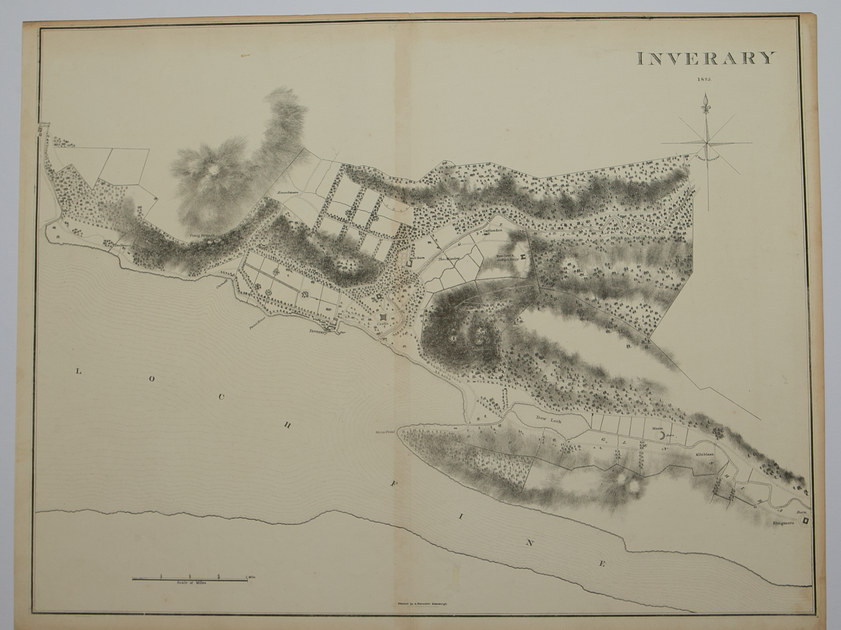
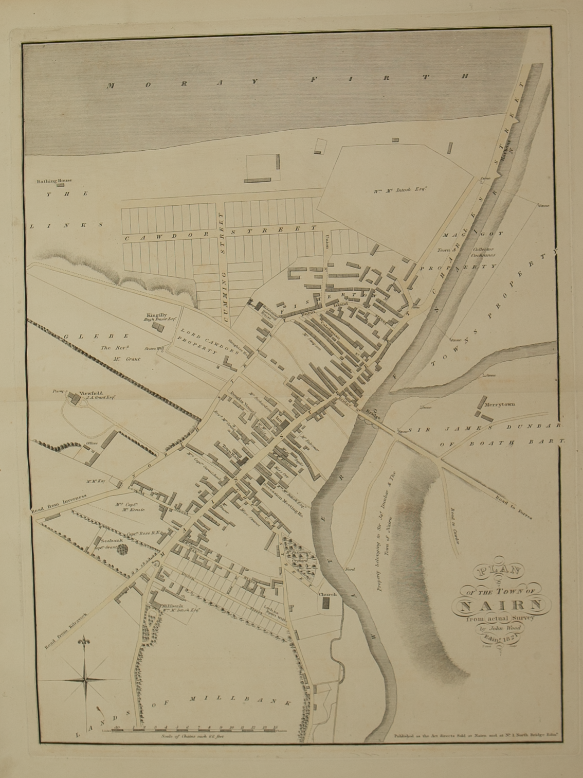
Brief Description: Plan is 1 of 48 town plans issued in John Wood’s “Town Atlas of Scotland” published in 1828; Nairn’s position on the Moray Firth coastline has led to it becoming a holiday location as well as an administrative centre; very good condition 

You Might Also Like

BZ4R6104.png BZ4R6104.png
Plan of Kirkwall
£50.00
BZ4R5709.png
Plan of the Town of Forres from actual survey by John Wood, Edinburgh in 1823
£75.00
BZ4R6139.png BZ4R6139.png
Plan of Wick
£50.00
BZ4R6193.png
Plan of the Town and Harbour of Stornaway, Island of Lewis, from actual survey by John Wood, Edinburgh 1821
£75.00
BZ4R6054.png BZ4R6054.png
Plan of Cromarty
£35.00
Email Us


Trading Terms & Customer Information


Scottish Pictures

Email: ian@scottishpictures.com


Privacy Policy