 Image 1 of 5
 Image 2 of 5
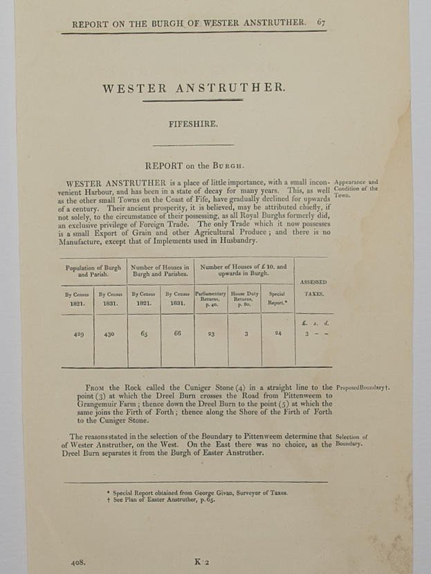 Image 3 of 5
 Image 4 of 5
 Image 5 of 5
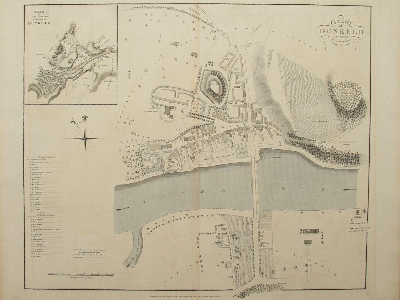
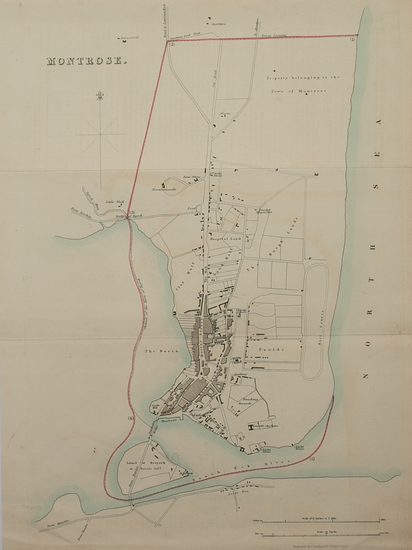
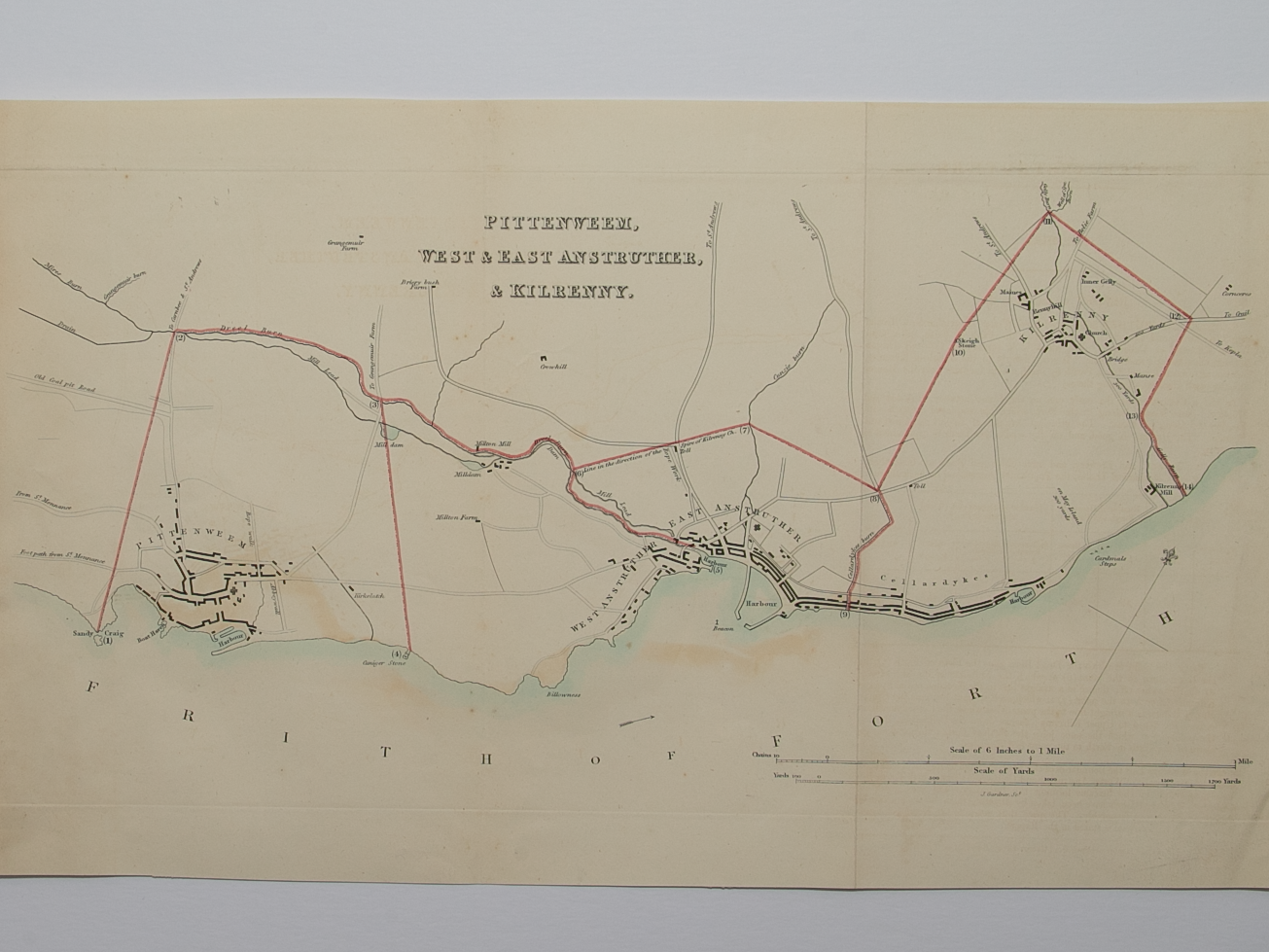
Brief Description: No offsetting of image present on plan; Boundaries Report document included with plan; folded item; very good condition