Plan of Dumbarton from actual survey by John Wood in 1818

£60.00

Cartographer / Engraver: John Wood / T. Clerk

Medium / Size: copperplate engraved plan / c.510 x 385mm

Date: 1818

Cartographer / Engraver: John Wood / T. Clerk

Medium / Size: copperplate engraved plan / c.510 x 385mm

Date: 1818

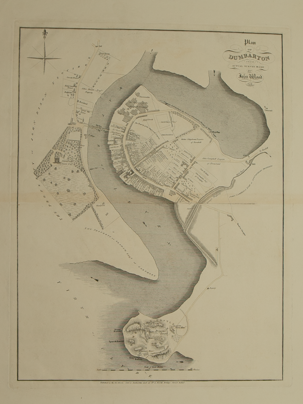
Brief Description: Plan is 1 of 48 town plans issued in John Wood’s “Town Atlas of Scotland” published in 1828; plan of Dumbarton Castle shows positional relationship to the town and the River Clyde; very good condition