Skip to Content
Scottish Pictures
Home
Maps
Views
Other Prints
Delivery
Contact
0
0
Scottish Pictures
Home
Maps
Views
Other Prints
Delivery
Contact
0
0
Home
Maps
Views
Other Prints
Delivery
Contact
Town Plans Paisley – Plan is an 1828 lithograph possibly from an original drawn by John Wood
BZ4R5721.png Image 1 of
BZ4R5721.png
BZ4R5721.png

Paisley – Plan is an 1828 lithograph possibly from an original drawn by John Wood

£75.00

Cartographer / Engraver: possibly John Wood / W.& A.K Johnston, Edinburgh

Medium / Size: lithograph / c.345 x 485mm

Date: 1828

Add To Cart

Cartographer / Engraver: possibly John Wood / W.& A.K Johnston, Edinburgh

Medium / Size: lithograph / c.345 x 485mm

Date: 1828

Cartographer / Engraver: possibly John Wood / W.& A.K Johnston, Edinburgh

Medium / Size: lithograph / c.345 x 485mm

Date: 1828

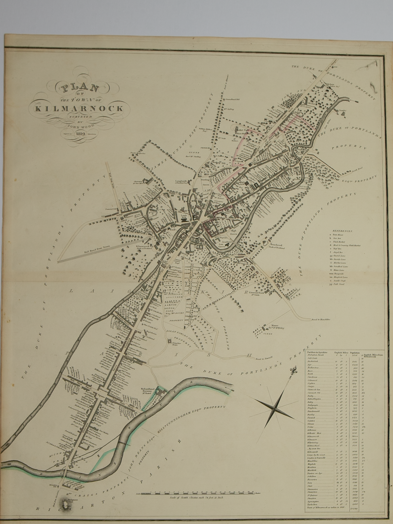
Brief Description: Plan is 1 of 48 town plans issued in John Wood’s “Town Atlas of Scotland” published in 1828; located a few miles west of Glasgow; very good condition 

You Might Also Like

BZ4R5706.png
Plan of Dumbarton from actual survey by John Wood in 1818
£60.00
BZ4R6123.png BZ4R6123.png
Plan of Port Glasgow
£45.00
BZ4R5710.png
Plan of the Town of Greenock from actual survey by John Wood, Edinburgh in 1825
£50.00
BZ4R5712.png
Plan of the Town of Irvine surveyed by John Wood, Edinburgh 1819
£50.00
BZ4R5714.png
Plan of the Town of Kilmarnock surveyed by John Wood in 1819
£60.00
Email Us


Trading Terms & Customer Information


Scottish Pictures

Email: ian@scottishpictures.com


Privacy Policy