Skip to Content
Scottish Pictures
Home
Maps
Views
Other Prints
Delivery
Contact
0
0
Scottish Pictures
Home
Maps
Views
Other Prints
Delivery
Contact
0
0
Home
Maps
Views
Other Prints
Delivery
Contact
Marine Charts - Road Maps - Geological Maps Edinburgh Firth
BZ4R5963.png Image 1 of
BZ4R5963.png
BZ4R5963.png

Edinburgh Firth

£250.00

Cartographer / Engraver: Captain Grenville Collins, marine surveyor / I. Collins

Medium / Size: copperplate engraved marine chart (hand coloured) / c.445 x 560mm

Date: c.1792

Add To Cart

Cartographer / Engraver: Captain Grenville Collins, marine surveyor / I. Collins

Medium / Size: copperplate engraved marine chart (hand coloured) / c.445 x 560mm

Date: c.1792

Cartographer / Engraver: Captain Grenville Collins, marine surveyor / I. Collins

Medium / Size: copperplate engraved marine chart (hand coloured) / c.445 x 560mm

Date: c.1792

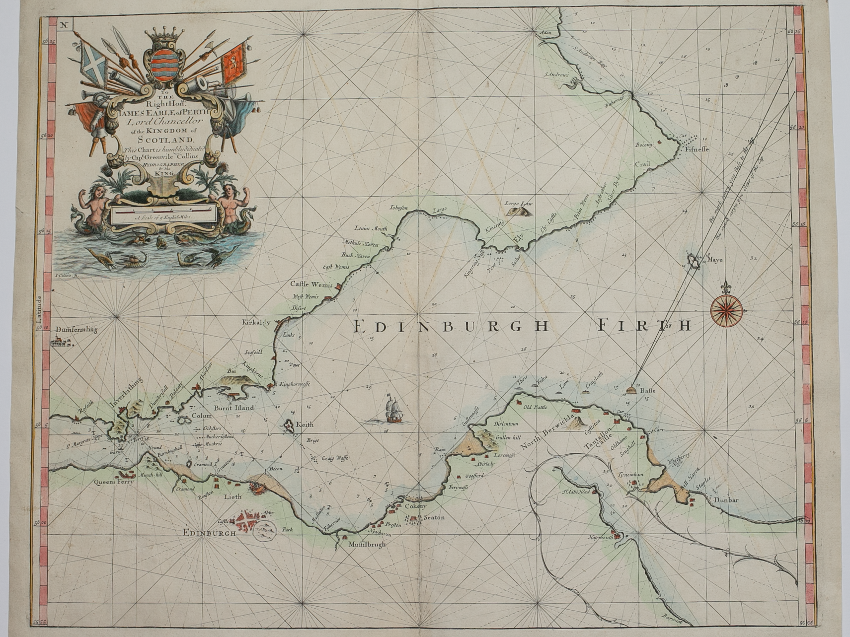
Brief Description: An original chart from Capt. Collins’ “Great Britain’s Coasting Pilot” first published in 1693, following a 7 year survey of the coasts of England and the east coast of Scotland 

You Might Also Like

BZ4R5967.png
Channel at Leith “Prospect of Leith from the East”
£150.00
BZ4R5966.png
The Firth of Murry
£150.00
Email Us


Trading Terms & Customer Information


Scottish Pictures

Email: ian@scottishpictures.com


Privacy Policy