Skip to Content
Scottish Pictures
Home
Maps
Views
Other Prints
Delivery
Contact
0
0
Scottish Pictures
Home
Maps
Views
Other Prints
Delivery
Contact
0
0
Home
Maps
Views
Other Prints
Delivery
Contact
Marine Charts - Road Maps - Geological Maps Bute, Cumbray (Great)
BZ4R6188.png Image 1 of
BZ4R6188.png
BZ4R6188.png

Bute, Cumbray (Great)

£45.00

Cartographer / Engraver: John Macculloch / J. Cross

Medium / Size: copperplate engraved map (original colour) / c.178 x 120mm

Date: 1819

Add To Cart

Cartographer / Engraver: John Macculloch / J. Cross

Medium / Size: copperplate engraved map (original colour) / c.178 x 120mm

Date: 1819

Cartographer / Engraver: John Macculloch / J. Cross

Medium / Size: copperplate engraved map (original colour) / c.178 x 120mm

Date: 1819

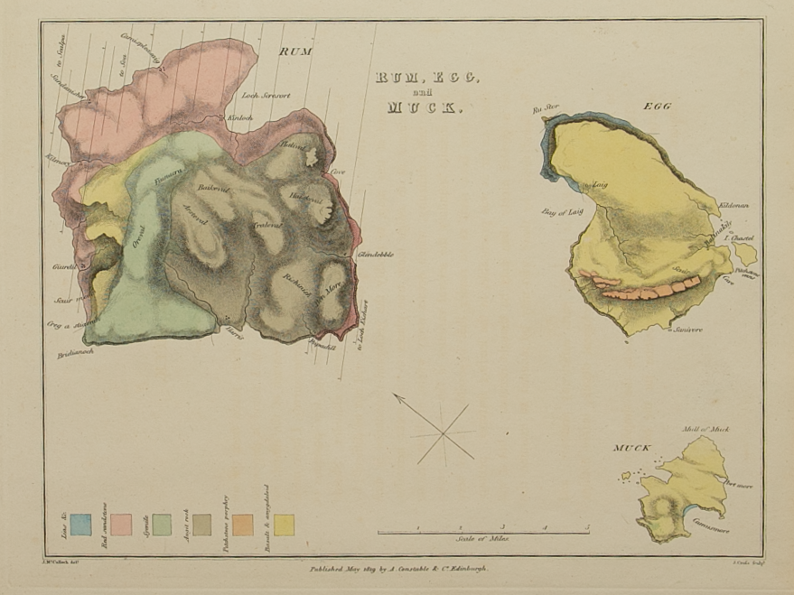
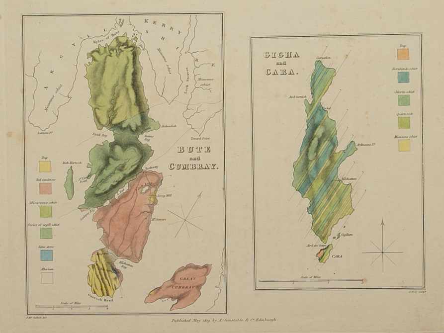
Brief Description: An early geological map from John Macculloch’s;

“A Description of the Western Islands of Scotland, including the Isle of Man, comprising an account of their Geological Structure ….”

n.b. map supplied with the original descriptive text relating to the map 

You Might Also Like

BZ4R6184.png
Mull, Iona, Ulva, Gometra, Inch Kenneth, The Treshinish Isles, Staffa, Colonsa, Eorsa
£95.00
BZ4R6186.png
Inish Capel, Kerrera, Seil, Eysdill, Luing, Torsa, Shuna, Garveloch Isles, Lunga, Scarba etc
£55.00
BZ4R6187.png
Isla, Jura, Colonsa, & Oransa
£75.00
BZ4R6182.png
Sky, Rasay, Flodda, Scalpa, Longa, Pabba, Scuir Dearg, Guillemon, the Croulin Isles, Soa
£125.00
BZ4R6181.jpg BZ4R6181.jpg
General map of the Western Isles
£150.00
Email Us


Trading Terms & Customer Information


Scottish Pictures

Email: ian@scottishpictures.com


Privacy Policy